Butcher Creek Natural Area
By providing this information, Red Deer River Naturalists assumes no liability whatsoever for your safety or wellbeing in the Natural Area. The farms immediately to the east and across the road to the south are private land and must not be entered without permission from the owners.
Note: Visitors should be aware that bears and cougars have been seen in the area. We suggest visiting in groups.
CAUTION: We do not recommend this natural area for young children.
Location: Drive southwest of Dickson Dam or west of Bowden to the intersection of Township Road 350 and Range Road 35. The entrance to the natural area is about 100 metres west of the intersection on the north side of the road.
N 51 58′ 11.12″ W 114 24′ 33.28
Click for detailed driving directions:
The parking lot: The road into the parking area has been severely damaged by careless use. Visitors are strongly advised to park near the road and enter on foot. The deep ruts will surely cause vehicles to become stuck or damaged. There is a small gate in the fence at the end of the parking lot. Please use the gate and do not crawl through the fence. The road (TWN 350) is seldom used and you may park on it. Please be sure to pull over far to the right so farm equipment may pass.
Motorized vehicles are not permitted in the natural area other than the parking lot. We strongly suggest that you not try to take vehicles into the parking lot as careless use has created deep ruts in the roadway. It is better to park at the roadway entrance and walk in. Fires, for any purpose are forbidden in the natural area.
 Suitability for children: Over 12; bushwhacking is involved
Mosquitoes: Usually not bad
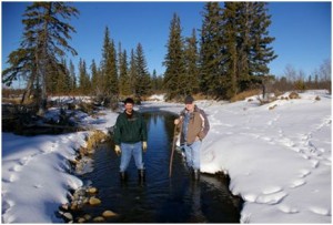
Footwear: Hiking boots/runners in dry areas; Rubber boots at creeks. marshes Please cross the creeks on the beaver dams or the gravel bars, never in the mud of the stream beds.
Hazards: Fallen trees, heavy bush, beaver ponds, deep water, marshes. You will probably find a walking stick useful.
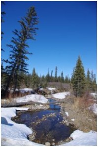
Accessibility: Butcher Creek Natural Area, measuring 205 ha, features a riverine habitat with the Red Deer River as the main stream. Numerous creeks flow into the river. Beavers have and continue to flood large areas. There are no developed trails so hikers have to bushwhack. The only practical way to cross the numerous creeks is on the beaver dams. Care is advised as the footing can be unstable and the water can be very deep along the upstream sides and the bottoms may have soft and very deep mud. You will find rubber boots and a walking stick useful when crossing.
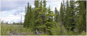
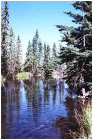
Features: This is a prime example of riparian habitat. From moist, moss-covered spruce woods to dry, open meadows, the Butcher Creek Natural Area contains a wide range of vegetation communities
Alder and willow thickets are found in the wet depressions, abandoned channels, islands, and on the shoreline. In the drier areas, aspen (Populus tremuloides) and balsam poplar (Populus balsamifera) forests flourish. The most visible plants in the Butcher Creek Natural Area are white spruce and aspen poplar. By looking more closely, though, you will discover many species of plants. The floor of the forest will reveal a huge variety of plants ranging from mosses to shrubs, orchids to ferns, and fungi to tall trees. Unwooded areas have a variety of prairie and semi-arid loving plants. Wolf willow (Elaeagnus commutata) has flourished in past few years and threatens to cover the meadow areas.
There are birds, but it takes patience to see them because of the thick brush.
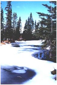
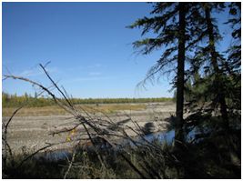
The river is braided in the natural area. In some times of the year, the river can easily be waded, in other times, especially June, it can be a swiftly moving torrent and the wise person stays well away. This natural area is truly a naturalists dream.
Some possible hikes:
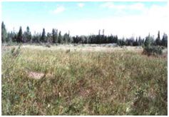
North from the parking lot: A large open space immediately to the north of the parking lot is the best area for small children. The fence on the east side marks private land, and must not be crossed. This family-friendly area is great for finding plants and insects. There are no water crossings. A few uncommon plant species have been found in here, but most are very common Central Alberta plants. Grasses are the most obvious, but there are many other plants to be found. There are lots of summer blooms to photograph and admire. Removal of plants, including picking bouquets, is strictly forbidden. We advise against crossing the swampy area at the north end of the open area. It is very rough and is often wet or flooded. Some years, beavers flood areas beyond the pasture. The pasture is the only part of the Natural Area you should visit without a GPS. Please do not remove any survey streamers you may come across. They have been put there by the Red Deer River Naturalists to mark certain features.
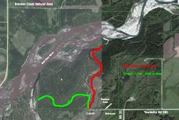
We have an aerial photo of Butcher Creek Natural Area taken from Google Earth. ™ To get a printable copy, please click on the map or click here.
Red hike: The red hike mainly follows animal trails and is the easiest hike after the parking lot and the pasture. Walk west on the road until you cross the culvert and then follow the creek northward. When you break free from the very thick wolf willow, veer westward until you come to a second creek. Follow that creek northward until you come to the Red Deer River.
The route is usually dry and can be walked wearing sneakers, definitely not sandals. Creeks in the natural area can have soft, deep mud bottoms and undercut shores. Children must be supervised carefully along the creek and river shores.
At the Red Deer River is a great view of stream braiding. On the way, you will find ant hills (please do not damage them), large white spruce trees (Picea glauca), wolf willow, and a huge variety of small plants on the forest floor. Birds, especially chickadees and spotted sandpipers, are often heard in the trees and along the streams.
The influence of the Red Deer River is clearly evident in the Butcher Creek Natural Area. Meandering across the flats, the river produces gravel/sand bars and islands constantly changing their size and shape.
The majority of the site is located on an old floodplain. As a result, there are numerous abandoned channels, some dammed by beavers that have filled with water and others only shallow, moist depressions. Vigourous plant growth and the large size of mature poplar and spruce trees are testimony to how flood waters have successfully replenished soil nutrients.
The Red Deer River links the mountains and foothills to the plains and is a particularly attractive travel corridor for wildlife. As more land is cleared along the river for agricultural and residential use, protecting the riverine habitat of the Butcher Creek Natural Area remains a priority.
While you probably will find your way without too much difficulty, you might want to carry a GPS just in case. Please do not remove any survey streamers you may come across. They have been put there by the Red Deer River Naturalists to mark certain features.
| GPS Coordinates |
North |
Min |
Sec |
West |
Min |
Sec |
| Entrance to natural area |
51 |
58 |
11.12 |
114 |
24 |
33.28 |
| Culvert |
51 |
58 |
10.72 |
114 |
24 |
39.91 |
| Enter Forest |
51 |
58 |
28.48 |
114 |
24 |
34.14 |
| Red Deer River |
51 |
58 |
46.31 |
114 |
24 |
33.15 |
Green hike: A compass or GPS is advised. It is very easy, especially on a cloudy day, to get turned around in the thick forest. Follow the road west until you cross a culvert. Follow the creek downstream for about 100 metres and then turn west to northwest. You will soon come to a swampy area. As there is no best crossing, you have to pick your way depending on the year. Once across the swamp, use your GPS to guide you northwest until you come to the next creek. Follow this creek upstream until you come to the Red Deer River. You might find it does not go all the way to the river. Note your exit from the forest carefully in order to find your way back. You may encounter quad trails and they will certainly make the walking easier, but you will miss the large variety of plants to photograph and admire. You will cross thick spruce forest (look for wintergreens tucked away on the floor), bogs containing Franklin’s or Sparrow’s egg lady’s slipper (Cypripedium passerinum), northern bog orchid (Habenaria hyperborea), a variety of grasses and sedges and shrubs), open areas when the plants change completely in a matter of a few metres, and aspen poplar forests. These poplar forests often have large logs from blow-downs which can be challenging to cross. At the river there are smaller trees on the floodplain. Please do not try to cross the river. It is quite swift. Please do not remove any survey streamers you may come across. They have been put there by the Red Deer River Naturalists to mark certain features.
These GPS Coordinates are subject to change depending on water levels and beaver dams.
| GPS Coordinates |
North |
Min |
Sec |
West |
Min |
Sec |
| Entrance |
51 |
58 |
46.31 |
114 |
24 |
33.15 |
| Culvert |
51 |
58 |
10.72 |
114 |
24 |
39.91 |
| Creek Crossing |
51 |
58 |
19.28 |
114 |
24 |
40.93 |
| Creek Crossing |
51 |
58 |
15.01 |
114 |
24 |
56.75 |
| Gravel beds |
51 |
58 |
16.20 |
114 |
25 |
21.90 |
| Red Deer River |
51 |
58 |
13.41 |
114 |
25 |
27.31 |
This list of biological layers is based on several sources:
- A tree layer, up to 30 m high. It includes the bark and limbs and upper trunk as well the leaves. It is inhabited by invertebrates and birds. In the lower canopy woodpeckers and nuthatches can be found.
- A small tree or sapling layer (up to 10 m), with not only younger specimens of the tall trees with species limited to this layer such as Saskatoon (Amelanchier alnifolia) or shade bush and dogwood. This layer supports moths, spiders, snails, centipedes and many other species.
- A shrub layer (1 – 6 m) often with members of the heath family. In the higher shrubs you may find eastern wood-pewee and red-eyed vireo. In the lower shrubs there may be bug nymphs and possibly a thrush.
- An herb layer of perennial forbs (0 – 100 cm) that bloom primarily in early spring. In the upper herb layer you should find nettles and other plants of their height. In the lower herb layer, there are many insect species and sometimes snails. Fallen and dead trees support a myriad of animal species.
The ground layer supports lichens, clubmosses, and true mosses. Lichens, mosses, and lichens are prolific
